Sunday, December 29, 2013

Caribou Ranch Open Space | A Mountain Elixir

Trail Head Coordinates:  N39°58.936’ W105°31.131’


My Dirt Life revolves around what lies beneath my feet.  My favorite terrain sounds more like an exotic drink than a cleared path through the Colorado wilderness.  A mixture of finely ground rock and reddish brown soil, a splash of mountain dew, seasoned just right with blue and green pine needles, and on the rocks of course.


Up here in the Rockies we have conditions to contend with and this time of year it’s the champagne powder Colorado is best known for.  For a mountain biker this can mean a lot of down time so this past weekend I decided on a more intimate excursion; snowshoeing and where else but Caribou country just outside Nederland Colorado.


I’m quickly falling for this little mountain community, so much so that I’m starting to look at real estate signs.  I recall on my trip to Mud Lake that the Caribou Ranch trail head was just up the road and although it’s early I figured there would be plenty of snow to give those snowshoes a workout.  Once at the parking area I quickly noticed that the snow depth was only about 2 to 6 inches, not enough for snowshoes I thought but that didn’t stop me from slipping into my Keen snow boots for an afternoon of solitude.


The whole trail consists of 2 routes; the DeLonde Trail and the Blue Bird Loop.  The whole hike is short by Colorado standards at about 3 miles but with the detours you can squeeze out about 3.25 miles.  It took me 3 hours to complete but I was taking my time as I explored new territory.  The trail itself is well groomed with minimal elevation changes and perfect for hikers of any skill level.  The trail is rich in mining history so take some time to read the plaques along the way.  The highlights are the DeLonde homestead and my favorite the Blue Bird mining complex – once the setting for vintage motion pictures.  Both features are well maintained and the older structures at Blue Bird are well preserved.


The wind was blowing mildly through the dense pine forest and in the clearings it was a bit chilly.  
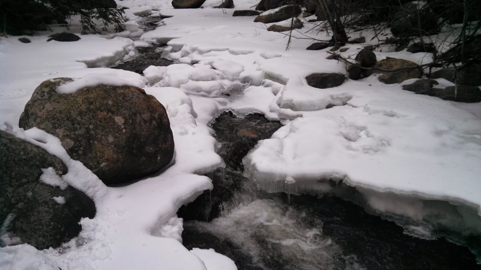
At times you could hear the wind swirling all around only to dissipate through the towering pine trees.  Along the way you’ll pass a beaver pond and running stream, both showing signs of winter this time of year.  The air was fresh and chill at about 40 degrees and the aromas delicately flavored the afternoon.


It was an afternoon free from the pressures of life and I didn’t want to leave.  It is early winter and West Boulder County will soon be covered in snow measuring in feet.  The snowshoes are back on the shelf but not for long.  The hike went down smooth with a fine finish...pour me another, I think I'll stay a while. 

Thanks for clicking in and I hope to see you on the trail.


Alan – Dirt Life   

Sunday, November 10, 2013

Switzerland Trail: Dirt Life Shrugged


Trailhead coordinates: N40°01.521’ W105°25.526

Riding the Switzerland Trail was like reading Atlas Shrugged; it was long, Colorado played a central role and the railroad was part of the central theme.  The Switzerland Trail is an old railroad grade that was used to transport people, supplies and ore between Boulder and the surrounding mountain communities from 1883 to 1919.  Curiously the tracks were destroyed by major flooding which threw the GSL&P rail line into bankruptcy.  The once bustling communities along Wall Street and in Sunset still remain and this ride will take you on an intimate ride along one of Colorado’s storied railroad routes in and around Four Mile Canyon.


I took the abandoned railroad, now a fire road, from the trailhead off Sugarloaf Road, down to Sunset then up the north side to Gold Hill Road and back.  The first leg of the trail gets a lot of shade and with the recent snow fall there remained a layer of hard packed snow and ice.  I like to think I have good brake control but these skills were not enough to prevent me from losing control and sliding down 20 yards or so on a hard sheet of ice.  I was lucky to come away with just a couple of scrapes and bruises – rubbed a little Dirt on ‘em and I was good to go.


In 3.89 miles you come to the sleepy little ‘ghost’ town of Sunset Colorado.  An important stop during the mining days of Colorado, a shell of the town remains but you will undoubtedly find a community that holds on to its historic past.  A quick glimpse to the west at just the right time will show you how this town got its name.  The trail continues on the other side of the road and the climb is long and steady.  It’s not a difficult climb but it is continuous and seems rather lengthy.  You finally reach Gold Hill Road at 8.48 miles.  About a mile before you reach Gold Hill you’ll come across one of the most curious landmarks along this trail – a tall and lonesome chimney surrounded by well placed picnic tables.  Also reachable by car, this would make a delightful picnic spot with great mountain views all around you.  Unfortunately there is no camping here but campsites aren’t far off.  The views are great and at times you’re able to catch a glimpse of the Indian Peaks just piercing the landscape to the west.


The trail itself is pretty rocky but most rocks aren’t much larger than a softball.  The loose stuff is no problem but does make the ride a bit uncomfortable if you’re not used to it.  Parts of the trail are relatively smooth and if you’re lucky a little muddy.  This weekend involved a fair amount of hard pack snow but only on the first leg of the ride.  Climbing back up this section wasn’t much of a problem but you’ll learn quickly to stay away from the shiny stuff going and coming.  This picture shows one of the few smooth sections.


The descents are exhilarating but the steep drop offs and loose terrain can make this trail very dangerous at high speed.  Maintain control at all times, especially in winter conditions.  It was tiresome but not terribly difficult.  The trail is an old rail line so take a few minutes to appreciate the cuttings along the way – imagine what it must have been like traveling by train back in the late 1800’s for the first time through the Rocky Mountains.


For me, a thousand pages are hard to get through once but the Switzerland Trail could have been 1000 miles long and I would not hesitate to do it again.  View the trail profile at connect.garmin.com/activity/401587100 and check out the player section to see the route in action.

A great afternoon!  Wall Street has been devastated by the recent floods but they're working hard to repair this great scenic drive.  Thanks for clicking in and I hope to see you on the trail.


Alan - Dirt Life

Wednesday, October 30, 2013

Betasso Preserve | Cheers! Boulder


Mountain biking in Colorado in the fall is like chocolate in your Dom PĂ©rignon; the trails are moist and dark and hidden beneath gold colored leaves and together make for one tasty treat.  Boulder County trails are coming back online after the horrific flooding recently, unfortunately some will take a while longer but we are happy to wait while those affected get back to normal.


It was going to hit the mid 60’s this weekend and with winter on the horizon we fat tire enthusiast have to hit the trails while we can.  My Moab plans were derailed this weekend but Boulder in the fall will never leave you wanting.


Boulder Canyon Drive is finally open and Betasso Preserve is only a few short minutes from downtown Boulder.  I entered through the Boulder Canyon link trail, which is sure to challenge the best riders.  Trail work has been done on this section to make it more rider friendly but the steep grade still requires strong legs and strong lungs.  With my TwinLoc system fully engaged and in a climbing position I headed up as far as I could before my ride was interrupted.  From here the grade was too steep for me to remount so I ended up walking for a short distance before I could keep going.  This section is steep and rocky so you’ll need to exercise certain skills to keep your front wheel on the ground.  If you have to stop, take caution when mounting up because the trail is very uneven and steep and the ledge looks muy peligroso.


If you can make it through this leg of the trail you’ll be treated to one of the finest trail systems in the area.  Full of twists and turns, the trail this weekend was tacky in all the right areas from the recent light snow fall.  Threading through dense forest, feathering my breaks to control my speed, the chill in the air surrounds you as you wind around on through to the sunny spots that are sure to warm the chill.  With the damp Dirt your tires can really hook up allowing the skilled riders to take the high bank turns, just be careful for wet roots and rocks as you come out of the turns.


It was a great ride.  Canyon loop was running clockwise, which I feel is a bit easier than the opposite direction.  Benjamin loop was running counter-clockwise and it seems to me that the level of difficulty is about equal in either direction.  This loop is worth the extra mileage so give it a shot if you get the chance.  Four Mile link was closed as I’m sure it has suffered some flood damage.  Please mind all the trail closures; they’ll open when they’re safe.
 

View the profile at connect.garmin.com/activity/397749590 and don't forget to mind the closures.  Have a great ride and hope to see you on the trails.

Dirt Life - Alan

Wednesday, October 9, 2013

Smoke 'em if you got 'em | The New Colorado Fatty


My window was cracked to breathe some fresh air into a stagnant room.  The nights’ silence is usually interrupted by the sound of crickets while the breeze stirs the waning leaves.  For the first time in months I awoke to complete silence – the day was October 4.

It’s 5:00am, I rub the sleep from my eyes then peek out the bedroom window only to find that winter is just around the corner – large wet snowflakes floating heavily, coating the landscape to look like a funnel cake garden.  I’m never sure how to react to the first signs of winter, I love the snow but it also means my favorite trails will be nearly impossible to ride; or will they?

From my previous posts you may gather that I have an unusual love affair with Dirt and the nobby tires that carry me through, so it should come as no surprise how delighted I was when I first discovered “Fat Bikes.”  The most distinguishing feature of the Fat Bike is its tires, hmmm.  Usually measuring 26x40, these tires are large enough to keep you above most sinking terrain.  Here in Colorado these bikes are especially popular in the winter to give us Dirt clods another option for riding our open space parks in the snow.

Most frames are rigid but you may find front and full suspension options around.  The large tires increases the weight of the bike so don’t expect it to handle like your trusty 26er.  Suspension will likely add considerable weight and coupled with the increased tire friction you’ll certainly need to be fit before mounting up for a snow ride.  The drivetrain options should help level off most trails so have no fear.

I have not had the pleasure of riding one of these personally but I have my eye on one in particular – the Salsa Mukluk; an aluminum frame, 2x10 drivetrain, Holy Rolling Darryl rims and Avid BB7 disc brakes.  Golden Bike Shop, located at 722 Washington Avenue in beautiful Golden Colorado has demos for rent and are currently building their fleet with choice options like the Surly Pugsley, Salsa Mukluk, 9:zero:7 and the Salsa Beargrease.  Their rates are $60/day for aluminum and $80/day for carbon.  You can find them on the web at www.goldenbikeshop.com or give them a call at (303) 278-6545 for more information.  The shop is located close to many open space parks so if you don't have a bike rack find a good parking spot, hop on a Fatty and head for the hills.

I can’t wait to give them a try for myself.  The recent snow has melted but sounds like there’s more on the way.  I promise myself that I will ride during winter regardless of the conditions but I can't seem to keep that promise, perhaps that would change if there were a Fat Bike in the garage.  There will be a Global Bike Summit in Ogden, UT on January 24-25.  I hope to make it out and if I’m able to attend I should have some great pics.  Till then, enjoy the weather and hope to see you on the trail.

Alan - Dirt Life